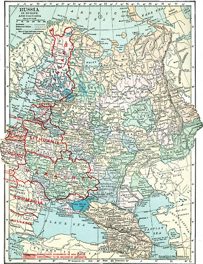
Description: A political map of Russia in Europe and Caucasia in 1920, revised to show the conjectural boundaries of the states of Finland, Esthonia, Livonia, Courland, Lithuania, Poland, Ukraine, Roumania, and Bulgaria, and the territory to the south of the Free City of Danzig (Gdansk), sovereignty to be decided by plebiscite. The map is color–coded to show the Russian provinces, and shows major cities, railways, submarine cable routes, and the city of Memel ceded by the Germans after WWI.
Place Names: Eastern Europe, Romania, �Poland, �Finland, �Livonia, �Estonia, �Courland, �Lithuania, �Germany, �Ukraine, �Czechoslovakia,�Hungary, �Roumania, �Bulgaria
ISO Topic Categories: boundaries,
location,
inlandWaters,
transportation
Keywords: Russia and Caucasia, physical, �transportation, kWWI, physical features, railroads,
water routes, boundaries,
location,
inlandWaters,
transportation, Unknown, 1920
Source: , Hammond's Modern Atlas of the World (New York, NY: C. S. Hammond and Company, Inc., 1920) 48
Map Credit: Courtesy the private collection of Roy Winkelman |
|