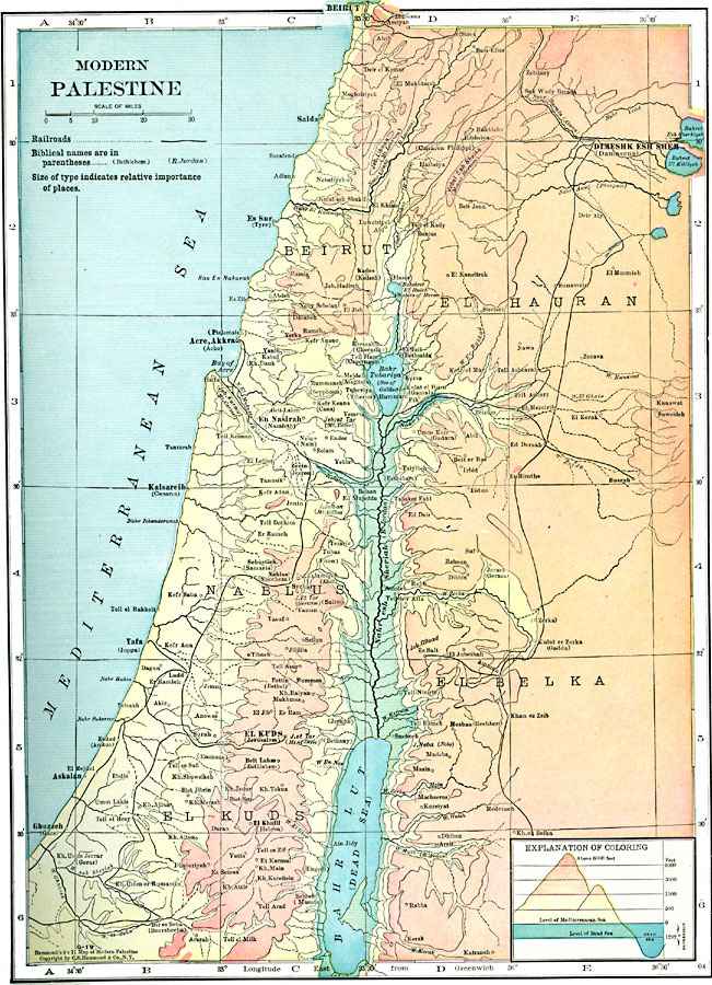
Description: A map from 1920 of Palestine as it was recognized at the time. This map shows the area roughly from Beirut to Ghuzzeh (Gaza) along the Mediterranean, and inland to Damascus and east of the Dead Sea. Place names are given in modern form, with Biblical names given in parentheses. The map uses color-contouring to show land elevations from the Mediterranean Sea level to above 6000 feet, and the depression lands from Dead Sea level (–1292 feet) to Mediterranean Sea level. This map shows cities, towns, ports, major roads, railroads, terrain, desert plains, lakes and seas, rivers, and coastal features of the region.
Place Names: Palestine, Beirut, �Nablus, �El Kuds, �El Hauran, �El Belka,
ISO Topic Categories:
Keywords: Modern Palestine, physical, �transportation, physical features, railroads, Unknown, 1920
Source: , Hammond's Modern Atlas of the World (New York, NY: C. S. Hammond and Company, Inc., 1920) 55
Map Credit: Courtesy the private collection of Roy Winkelman |
|