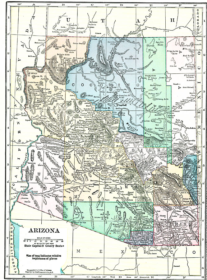
Description: A map of Arizona from 1920 showing the State capital of Phoenix, counties and county seats, major cities and towns, railroad lines, mountains, rivers, and the Grand Canyon.
Place Names: Arizona, Bisbee, �Yuma, �Tucson, �Phoenix, �Prescott, �Globe, �Clifton, �Douglas, �Jerome, �Nogale
ISO Topic Categories: boundaries,
location,
inlandWaters
Keywords: Arizona, physical, �political, physical features, county borders, boundaries,
location,
inlandWaters, Unknown, 1920
Source: , Hammond's Modern Atlas of the World (New York, NY: C. S. Hammond and Company, Inc., 1920) 119
Map Credit: Courtesy the private collection of Roy Winkelman |
|