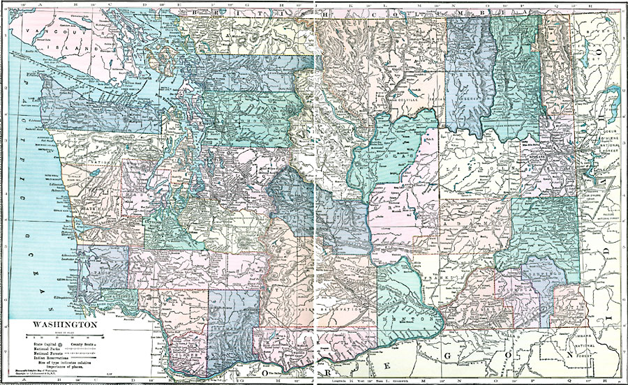
Description: A map from 1920 of Washington showing the capital, Olympia, counties and county seats, principal cities and towns, Indian reservations, National Park and Forest boundaries, railroads, mountains, lakes, rivers, and coastal features of the Puget Sound and Pacific.
Place Names: Washington, Olympia, �Seattle, �Bellingham, �Everett, �North Yakima, �Oysterville, �Spokane, �Tacoma, �Tumwater, �Walla Wall
ISO Topic Categories: boundaries,
location,
inlandWaters,
oceans
Keywords: Washington, physical, �political, kNativeAmerican, physical features, county borders, boundaries,
location,
inlandWaters,
oceans, Unknown, 1920
Source: , Hammond's Modern Atlas of the World (New York, NY: C. S. Hammond and Company, Inc., 1920) 126-127
Map Credit: Courtesy the private collection of Roy Winkelman |
|