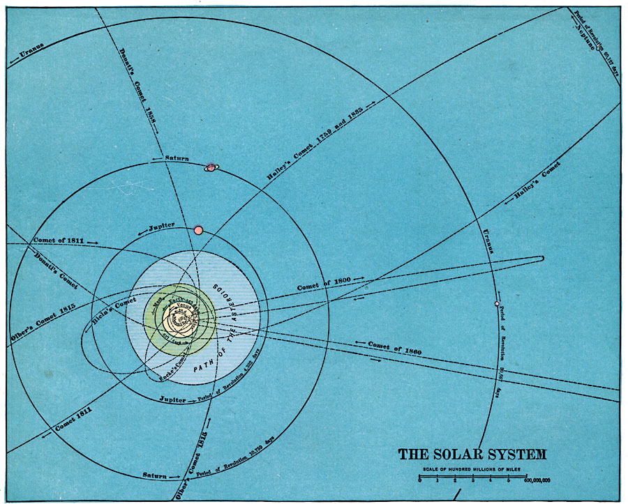
Description: A chart of the solar system from 1920. This chart extends to the planet Neptune (discovered as a planet of the solar system in 1846), and shows the period of revolution around the sun for each of the planets, the path of the asteroids (asteroid belt), and the paths of major comets, including Halley's, Olber's, Enke's, Biela's, Donati's, and three unnamed comets. The map scale is in hundred of millions of miles.
Place Names: Solar System, Venus, �Uranus, �Saturn, �Neptune, �Mercury, �Mars, �Jupiter, �Eart
ISO Topic Categories:
Keywords: Solar System, Unknown, 1920
Source: , Hammond's Modern Atlas of the World (New York, New York: C. S. Hammond and Company, Inc., 1920) 128
Map Credit: Courtesy the private collection of Roy Winkelman |
|