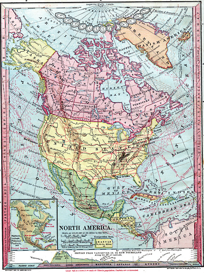
Description: A map from 1872 of North America, Central America, Greenland, and Caribbean showing political boundaries at the time, capitals and major cities, railroads, ship routes with distances between major ports given, mountain systems, rivers and coastal features. The ship routes are marked to indicate number of days required to make passage, and, because this map pre–dates the opening of the Panama Canal, routes are shown to the Panama isthmus, Nicaraguan crossing point, and the longer overland route from Veracruz in Mexico. The map shows ocean currents with direction of flow given, and the extreme limits of Atlantic icebergs. Clock symbols at the top of the map indicate time zones based on noon London time. Longitude from Greenwich is shown at the top of the map, and from Washington at the bottom. The right and left margins show comparative latitudes and temperatures for various countries around the world, and an outline map of Kansas at the same map scale shows comparative area size. An inset map shows the general highlands and lowlands, principle products, and principal sea ports of the region. At the bottom of the map is a chart showing a cross–section vertical profile of North America from Vancouver Island on the Pacific to Newfoundland on the Atlantic.
Place Names: A Complete Map of North America, Bahamas, �Canada, �Cuba, �Mexico, �United States, �Central America, �West Indies,
ISO Topic Categories: boundaries,
elevation,
oceans,
location,
inlandWaters,
transportation,
climatologyMeteorologyAtmosphere
Keywords: North America, physical, �hydrological, �transportation, �meteorological, kComparativeArea, physical features, water routes, temperature, currents, boundaries,
elevation,
oceans,
location,
inlandWaters,
transportation,
climatologyMeteorologyAtmosphere, Unknown, 1872
Source: James Monteith, Comprehensive Geography (New York, NY: A. S. Barnes and Company, 1872) 16
Map Credit: Courtesy the private collection of Roy Winkelman |
|