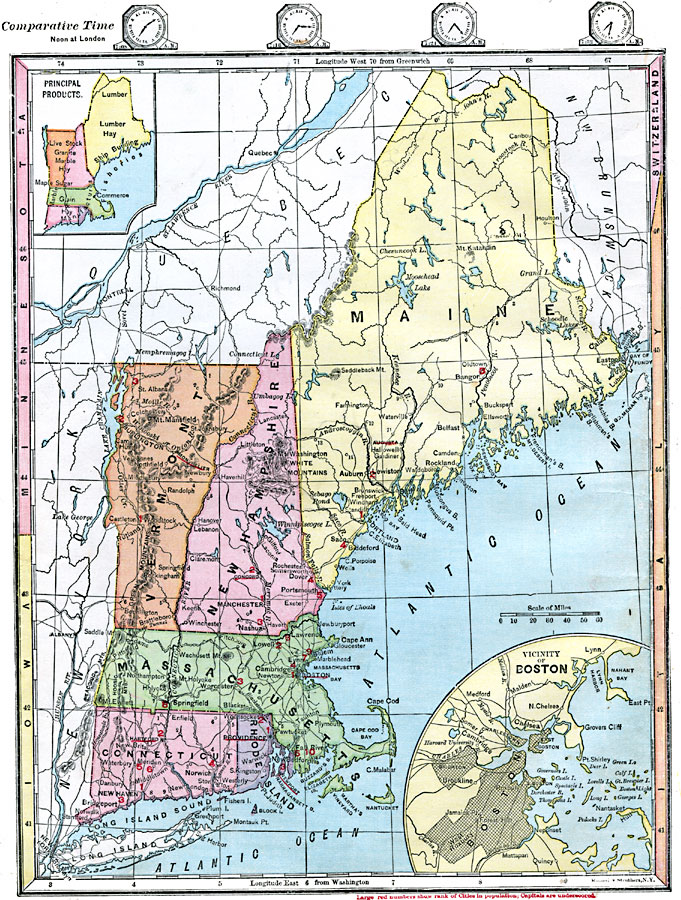
Description: Maine, New Hampshire, Vermont, Massachusetts, Rhode Island, and Connecticut. Includes inserts of principal products and of the Boston vicinity. Time zones are provided. Red numbers indicate the rank of cities in population.
Place Names: New England States, Boston, �Massachusetts, �Hartford, �Connecticut,�Augusta, �Maine, �Concord, �New Hampshire, �Montpelier, �Vermont, �Providence, �Rhode Island, ��New Englan
ISO Topic Categories: boundaries,
inlandWaters,
location,
oceans,
farming,
economy,
society
Keywords: New England States, physical, �statistical, physical features, population,
agriculture,
economic, boundaries,
inlandWaters,
location,
oceans,
farming,
economy,
society, Unknown, 1872
Source: James Monteith, Comprehensive Geography (New York, NY: A. S. Barnes and Company, 1872) 26
Map Credit: Courtesy the private collection of Roy Winkelman |
|