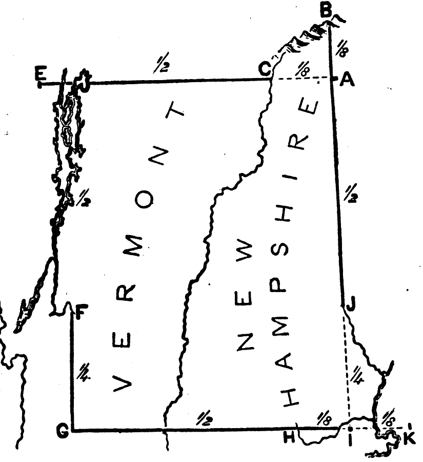
Description: Illustrates instructions for drawing New Hampshire and Vermont.
Place Names: New England States, New Hampshire, �Vermont, �New Englan
ISO Topic Categories: location,
inlandWaters,
boundaries
Keywords: Drawing New Hampshire and Vermont, physical, �map drawing, �kmapdraw, kMapSkills, physical features, location,
inlandWaters,
boundaries, Unknown, 1872
Source: James Monteith, Comprehensive Geography (New York, NY: A. S. Barnes and Company, 1872) 28
Map Credit: Courtesy the private collection of Roy Winkelman |
|