mapsMaps ETC Site map
 Maps ETC > United States > Growth of Nation > The Territory of the United States before and after the Louisiana Purchase, 1783–1803
Site Map 

The Territory of the United States before and after the Louisiana Purchase, 1783–1803

The Territory of the United States before and after the Louisiana Purchase


Title: The Territory of the United States before and after the Louisiana Purchase
Projection: Unknown,
Source Bounding Coordinates:
W: E: N: S:

Main Map Page
Zoomify Version
B/W PDF Version
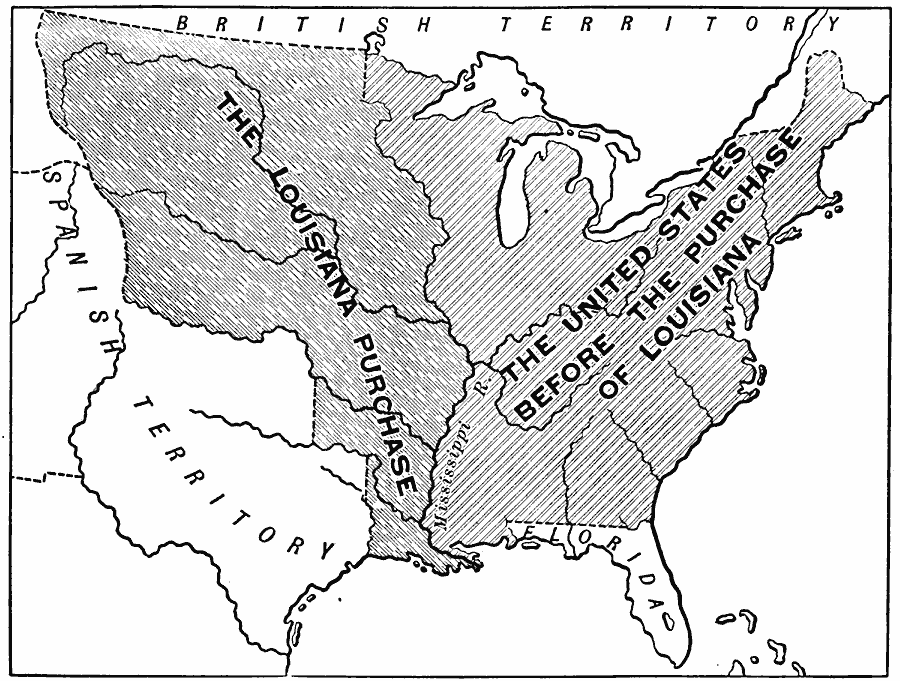
Description: A map of the United States showing the extent of the country prior to, and after the Louisiana Purchase from France in 1803.
Place Names: Growth of Nation, Louisiana Purchase, Spanish Territor
ISO Topic Categories: oceans, location, inlandWaters
Keywords: The Territory of the United States before and after the Louisiana Purchase, borders, political, historical, country borders, historical event, oceans, location, inlandWaters, Unknown, 1783–1803
Source: Gertrude van Duyn Southworth, A First Book in American History (New York, NY: D. Appleton and Co. , 1907) 218
Map Credit: Courtesy the private collection of Roy Winkelman
SearchLicensePDF HelpGIS Help Google Earth Help Zoomify Help

 Maps ETC > United States > Growth of Nation > The Territory of the United States before and after the Louisiana Purchase, 1783–1803
Site Map