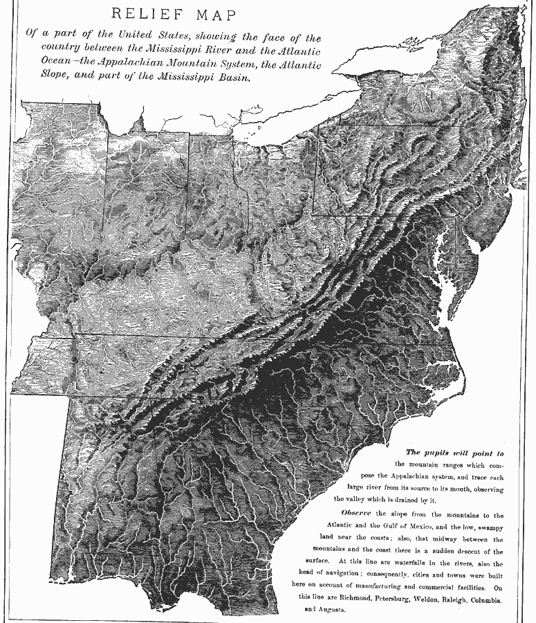
Description: A relief map from 1872 of the United States east of the Mississippi River. This map was used as a classroom exercise, giving instructions for the pupils to locate specific points on the map. The map shows terrain features of the Appalachian Mountain system, Atlantic Slope, and part of the Mississippi Basin, and notes the fall line between the Piedmont and coastal plain, explaining the importance as the head of navigation for rivers in the region, and the sites of Richmond, Petersburg, Weldon, Raleigh, Columbia, and Augusta.
Place Names: Eastern States, Illinois, �Indiana, �Ohio, �New York, �Pennsylvania, �New Jersey, �Virginia, �West Virginia, �North Carolina, �South Carolina, �Georgia, �Alabama,�Mississippi, �Tennessee, �Kentucky, �Appalachian Mountains, �East Coast, �Mid-Atlantic State
ISO Topic Categories:
Keywords: Relief Map of the States East of the Mississippi River, physical, kRelief, physical features, Unknown, 1872
Source: James Monteith, Comprehensive Geography (New York, NY: A. S. Barnes and Company, 1872)
Map Credit: Courtesy the private collection of Roy Winkelman |
|