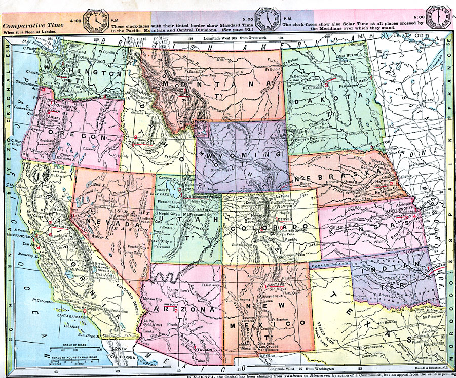
Description: The western half of the United States, showing physical features. Time zones are provided. Red numbers indicate the rank of cities in population.
Place Names: Western States, San Diego, �Seattle, �Washington, �Oregon, �California, �Nevada, �Idaho, �Montana, �Dakota, �Wyoming, �Nebraska, �Utah, �Colorado, �Kansas, �Arizona, �New Mexico, �Texas, �Pacific Ocean, �Pacific States, �Rocky Mountains, �Washington Stat
ISO Topic Categories: boundaries,
location,
inlandWaters,
oceans
Keywords: Western Half of the Union, physical, �statistical, physical features, population, boundaries,
location,
inlandWaters,
oceans, Unknown, 1872
Source: James Monteith, Comprehensive Geography (New York, NY: A. S. Barnes and Company, 1872) 44
Map Credit: Courtesy the private collection of Roy Winkelman |
|