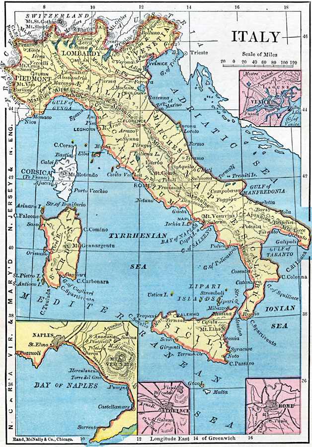
Description: A map of Italy in 1872 showing the provinces of Piedmont, Lombardy, Venetia, &Aelig;milia, Republic of San Marino, Tuscany, Marches, Latium, Naples, Calabria, Sicily, and Sardonia. This map shows major cities, rivers, mountain systems, and includes inset maps of Venice, Rome, Florence, and the Bay of Naples. On the left–hand edge of the map are latitude references to North Carolina, Virginia, Maryland, New Jersey, and New England.
Place Names: Italy, Florence, �Rome, �Venice, �Genoa, �Pisa, �Naples, �Bologna, �Verona, �Mila
ISO Topic Categories: boundaries,
location,
inlandWaters
Keywords: Italy, physical, physical features, boundaries,
location,
inlandWaters, Unknown, 1872
Source: James Monteith, Comprehensive Geography (New York, New York: A. S. Barnes and Company, 1872) 72
Map Credit: Courtesy the private collection of Roy Winkelman |
|