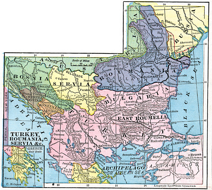
Description: A map from 1872 of the Balkan region, showing the Ottoman territories of European Turkey, Bulgaria, and East Roumelia, and the territories of Bosnia, Servia, Roumania, Herzegovina, Montenegro, and the territory to be ceded to Greece. The map shows cities, towns, railways, rivers, and mountain systems in the region. An inset map shows Greece at half scale to the main map, and the latitude comparison to New York and Pennsylvania.
Place Names: Southeastern Europe, Romania, �Greece, �Bosnia, �Servia, �Russia, �Herzegovina, �Montenegro, �Turkey, �Bulgaria,
ISO Topic Categories: boundaries,
location,
inlandWaters
Keywords: Turkey, Roumania, Servia, and Neighboring Countries, physical, kEuropeanOttomanEmpire, physical features, boundaries,
location,
inlandWaters, Unknown, 1872
Source: James Monteith, Comprehensive Geography (New York, NY: A. S. Barnes and Company, 1872) 75
Map Credit: Courtesy the private collection of Roy Winkelman |
|