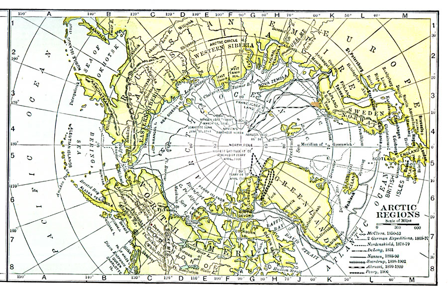
Description: A map of the North Polar Region from 1911 showing the routes of expeditions from 1850–1906 including the routes of McClure (1850–1853), the German expeditions of 1869–1870, Nordenskiold (1878–1879), De Long (1881), Nansen (1893–1896), Sverdrup (1898–1902), Abruzzi (1899–1900), and the Peary expeditions of 1900, 1902, and 1906.
Place Names: Arctic Region, Alaska, �Canada, �Greenland, �Iceland, �Russi
ISO Topic Categories: oceans,
location,
inlandWaters
Keywords: Arctic Region Exploration, borders, �political, �historical, country borders, historical event, oceans,
location,
inlandWaters, Unknown, 1850–1906
Source: George Edwin Rines, ed., The United Editors Perpetual Encyclopedia (New York, NY: United Editors Association, 1911)
Map Credit: Courtesy the private collection of Roy Winkelman |
|