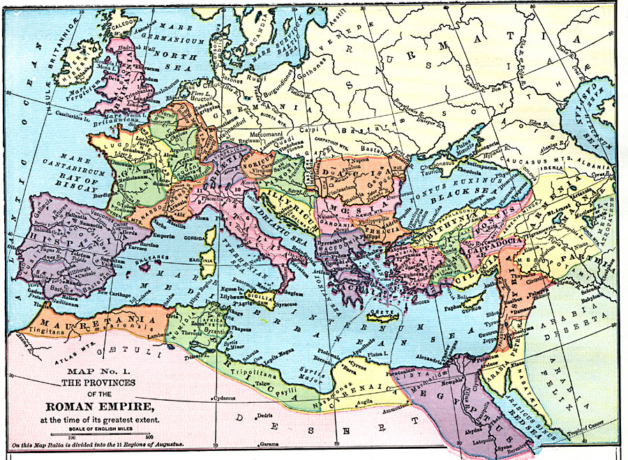
Description: The provinces of the Roman Empire, at the time of its greatest extent. — Comprehensive Geography, 1872
Place Names: Regional Mediterranean, Africa, �Asia, �Europe, �Britania,�Hispania, �Mauretania, �Cyrenaica, �Egyptus, �Syria, �Armenia, �Sarmatia, �Italia, �Gallia,
ISO Topic Categories: physical, �political, kWorldMedSea, kWorldAfroAsia, kWorldEurasia, kWorldEuroAfrica
Keywords: Provinces of the Roman Empire, physical, �political, physical features, country borders, physical, �political, kWorldMedSea, kWorldAfroAsia, kWorldEurasia, kWorldEuroAfrica, Unknown, About the beginning of the Christian era (A.D.)
Source: James Monteith, Comprehensive Geography (New York, New York: A. S. Barnes and Company, 1872) 90
Map Credit: Courtesy the private collection of Roy Winkelman |
|