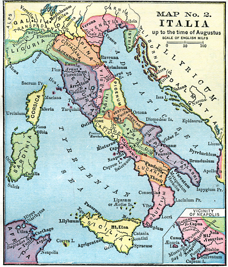
Description: A map of Italy prior to the ascension of Augustus Caesar in 27 BC. The map shows the Roman territories of the peninsula south of the Alps and east of the River Varus (Var), and includes the islands of Corsica, Sardinia, and Sicily, the territories in Tunis Africa (Utica, Carthage, and Aspis), Istria, and the coastal area of Illyricum on the Adriatic Sea. The roads from Rome to Ariminum–Placentia and Tarentum–Brundusium are shown. An insert map details the vicinity around Neapolis (Naples), including Mt. Vesuvius, Herculaneum, and Pompeii.
Place Names: Italy, Verona, �Venice, �Pisa, �Rome, �Genna, �Neopolis, �Florentia, �Sicilia, �Sardinia, �Corsica, �Tyrrhenian Sea, �Adriatic Sea,
ISO Topic Categories: boundaries,
location,
inlandWaters
Keywords: Italia Up to the Time of Augustus, physical, �political, kRomanEmpire, physical features, county borders, boundaries,
location,
inlandWaters, Unknown, 27 BC
Source: James Monteith, Comprehensive Geography (New York, New York: A. S. Barnes and Company, 1872) 91
Map Credit: Courtesy the private collection of Roy Winkelman |
|