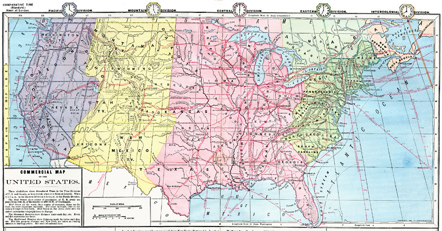
Description: A commercial map from 1872 of the United States showing the principal railroad and steamship routes in the region at the time. The map shows state boundaries and capitals, major cities and ports, submarine telegraph cables to Europe, rivers, mountain systems, and coastal features. Clock symbols at the top of the map show the local time for each standard time zones based on noon, London. Longitude from Greenwich is given at the top of the map, and from Washington at the bottom. The steamship and railroad routes show the time required to travel between points, and a 10–hour railroad scale is given at the bottom of the map. The mean centers of population are given based on the census from 1790 to 1880.
Place Names: A Complete Map of the United States, Boston, �Chicago, �Houston, �New York, �New Orleans, �Washington D.C
ISO Topic Categories: inlandWaters,
location,
oceans,
transportation
Keywords: Commercial Map of the United States, physical, �transportation, physical features, railroads,
water routes, inlandWaters,
location,
oceans,
transportation, Unknown, 1872
Source: James Monteith, Comprehensive Geography (New York, NY: A. S. Barnes and Company, 1872) 92-93
Map Credit: Courtesy the private collection of Roy Winkelman |
|