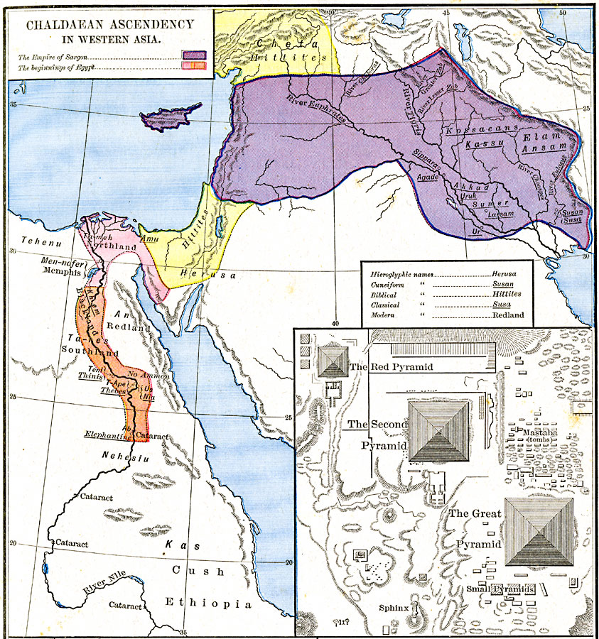
Description: A map showing the Chaldaean or Neo–Babylonian Ascendancy in Western Asia. This map is color-coded to show the empire of Sargon of Akkad (2270 to 2215 BC) in purple, the territories of the Hittites in Herusa and Cheta in yellow, and the area where the Egyptian dynasties began along the Nile in pink (Lower Egypt, or the North–land, ta–meh) and orange (Upper Egypt, or South–land, ta–res). The map shows important historical cities of the time and rivers, using name forms (hieroglyphic, cuneiform, biblical, classical, and modern) where appropriate. An inset details the pyramids, mastaba (tombs), and sphinx of Giza near Men–nofer (Memphis), Egypt. "During the 4th dynasty (about 2700 B.C.) the greater part of the pyramid–tombs were erected in the necropolis of Memphis, on the edge of the Western desert. Traces and remains of more than seventy still exist. The largest, built by Khufu, or Cheops, was originally 480 feet high and still measures 450 feet. The second pyramid, which was built by Khafra, measured 453 feet (at present 450 feet). The third one, frequently called the Red Pyramid, was built by Menkaura (Mycerinus)." — Labberton, 1886, p.2.
Place Names: Southwest Asia, China, �Ethiopia, �Japa
ISO Topic Categories: oceans,
location,
inlandWaters
Keywords: Chaldaean Ascendancy in Western Asia, borders, oceans,
location,
inlandWaters, Unknown, about 3800 BC
Source: Robert H. Labberton, New Historical Atlas and General History (New York, NY: Townsend Mac Coun, 1886) Plate I
Map Credit: Courtesy the private collection of Roy Winkelman |
|
