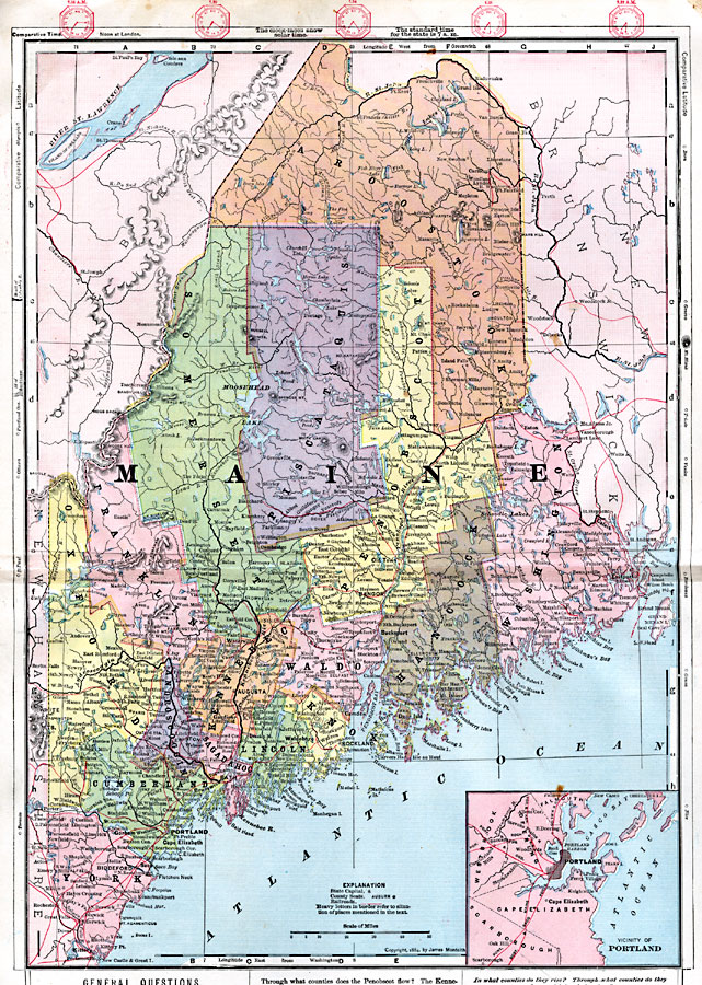
Description: A map from 1872 of Maine showing the State capital of Augusta, counties and county seats, major cities, towns and ports, railroads, mountains, lakes, rivers, and coastal features. An inset map details the vicinity of Portland. Clock symbols at the top of the map show local times based on noon in Greenwich. Latitudes at the bottom of the map are based on the Washington Prime Meridian.
Place Names: Maine,
ISO Topic Categories: boundaries,
inlandWaters,
location,
oceans,
transportation
Keywords: Maine, physical, �political, �transportation, physical features, county borders, railroads, boundaries,
inlandWaters,
location,
oceans,
transportation, Unknown, 1872
Source: James Monteith, Comprehensive Geography (New York, NY: A. S. Barnes and Company, 1872) s/2-3
Map Credit: Courtesy the private collection of Roy Winkelman |
|