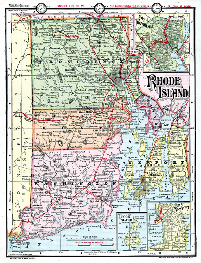
Description: A map from 1872 of Rhode Island, with map inserts of Providence, Newport, and Block Island. The map shows counties and county seats, principal cities, ports, and towns, railroads, terrain and coastal features, and rivers. Clock symbols at the top of the map indicate solar time compared to the local time zones based on noon, London time. Longitudes west from Greenwich are given at the top of the map, east from Washington at the bottom. A travel–time scale for railroads is given.
Place Names: Rhode Island, Narragansett Pier, �Newport, �Greenwich, �Kingston, �Providence, �Woonsocket, �Pawtucket, �Bristol, �Warre
ISO Topic Categories: boundaries,
location,
inlandWaters,
oceans,
transportation
Keywords: Rhode Island, physical, �political, physical features, county borders, railroads, boundaries,
location,
inlandWaters,
oceans,
transportation, Unknown, 1872
Source: James Monteith, Comprehensive Geography (New York, NY: A. S. Barnes and Company, 1872) s/28
Map Credit: Courtesy the private collection of Roy Winkelman |
|