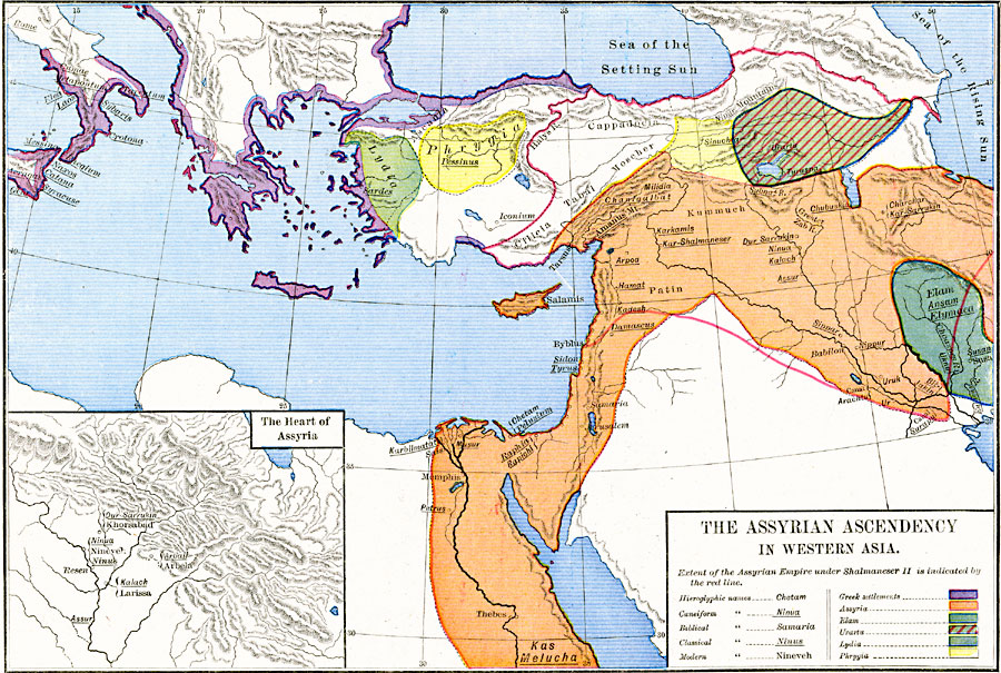
Description: A map of Western Asia showing the extent of the first Assyrian Empire under Shalmaneser II (859–824 BC) to the fall of the empire around 660 BC. The map is color–coded to show the full extent of the Assyrian Empire, the Greek settlements in southern Italy, Greece, and Asia Minor along the Aegean and Black Sea coasts, the territory of Elam in Babylonia, the Kingdom of Urartu in eastern Anatolia, Lydia in western Anatolia, and Phrygia in central Anatolia. ). The map shows important historical cities of the time and rivers, using name forms (hieroglyphic, cuneiform, biblical, classical, and modern) where appropriate. Historic place names include ‘Sea of the Rising Sun’ (Caspian Sea), ‘Sea of the Setting Sun’ (Black Sea), and ‘Salamis’ (Cyprus). An inset map details the heart of Assyria in the upper Tigris plain, showing the four capital cities of Nineve, Assur, Kalach, and Dur–Sarrukin.
Place Names: Southwest Asia, Assyria, �Babylon, �Elam, �Israel, �Jerusalem, �Kas Melucha, �Lydia, �Phrygia, �Samaria, �Urart
ISO Topic Categories: oceans,
location,
inlandWaters
Keywords: The Assyrian Ascendancy in Western Asia, borders, �political, major political subdivisions, oceans,
location,
inlandWaters, Unknown, 859–660 BC
Source: Robert H. Labberton, New Historical Atlas and General History (New York, NY: Townsend MacCoun, 1886) Plate VI
Map Credit: Courtesy the private collection of Roy Winkelman |
|
