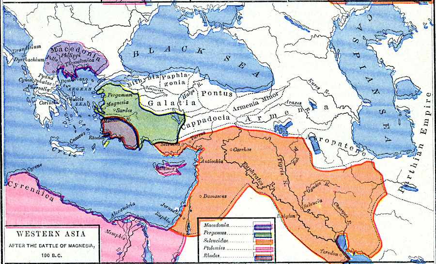
Description: A map of western Asia after the Battle of Magnesia (190 BC), where the Romans defeated the army of Antiochus III of the Seleucid Empire during the Roman–Syrian War. This map is color–coded to show the territories at the time of Macedonia, Pergamus, Seleucidae, Ptolemis, and Rhodes. Provincial borders of the time, rivers, and important cities are shown.
Place Names: Southwest Asia, Cyrenaica, �Macedonia, �Parthian Empire, �Pergamus, �Ptolemies, �Rhodes, �Seleucida
ISO Topic Categories: oceans,
location,
inlandWaters,
boundaries
Keywords: Western Asia After the Battle of Magnesia, borders, �political, major political subdivisions, oceans,
location,
inlandWaters,
boundaries, Unknown, about 190 BC
Source: Robert H. Labberton, New Historical Atlas and General History (New York, NY: Townsend MacCoun, 1886) Plate XII
Map Credit: Courtesy the private collection of Roy Winkelman |
|