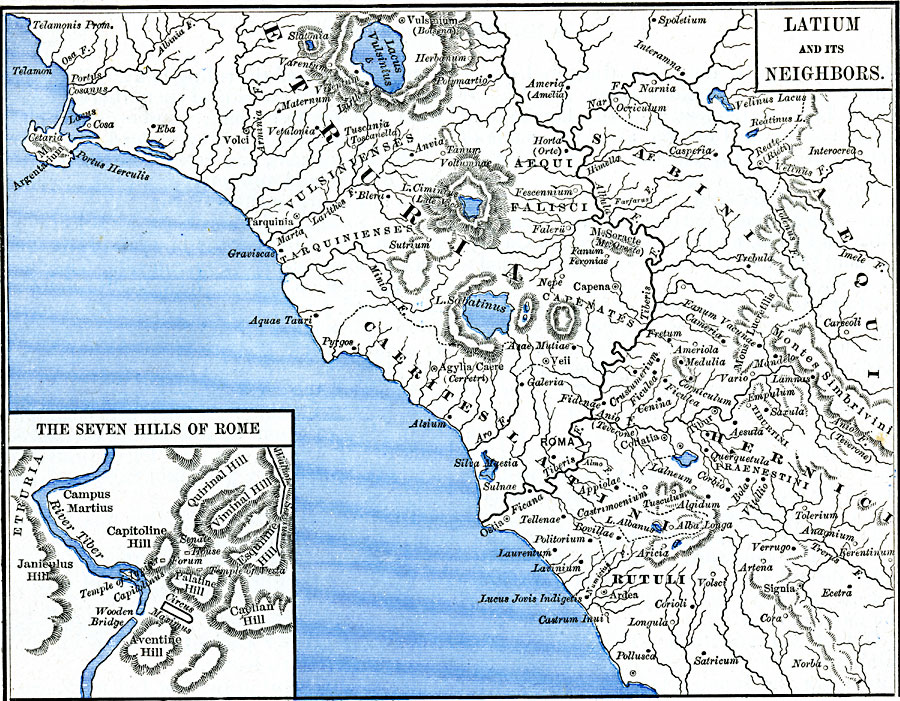
Description: A map of Latium and Neighbors around the earliest time of Rome. This map shows the territories of Caerites Latini, Sabini, Etruria, and others, as well as important cities of the time, major rivers and lakes, coastal features, and terrain. An inset map titled, "The Seven Hills of Rome" shows the terrain and historic sites of early Rome.
Place Names: Italy, Aequi, �Caerites Latini, �Etruria, �Hernici, �Rome, �Rutuli, �Sabin
ISO Topic Categories: oceans,
location,
inlandWaters
Keywords: Latium and Neighbors, borders, kAncientRome, oceans,
location,
inlandWaters, Unknown, 750 BC
Source: Robert H. Labberton, New Historical Atlas and General History (New York, NY: Townsend MacCoun, 1886) Plate XIII
Map Credit: Courtesy the private collection of Roy Winkelman |
|