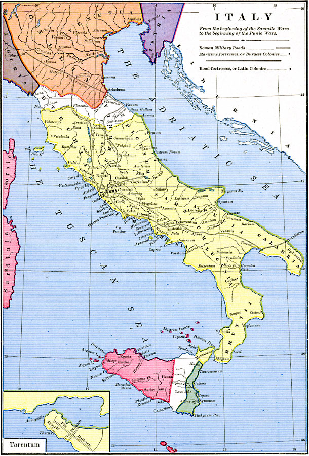
Description: Map of Italy, from the beginning of the Samnite Wars (343 BC) to the beginning of the Punic Wars (264 BC). The map is color–coded to show portions of the Liguria, Gallia, Venetia, and Istria territories in the north, the Carthaginian, Greek, and Roman territories on Sicily, and the peninsular territories of Etruria, Umbria, Picenum, Latium, Campania, Samnium, Apulia, Calabria, Lucania, and Bruttii. Important cities of the time are shown, as well as Roman military roads, maritime fortresses, or Burgess colonies, and road–fortresses, or Latin colonies.
Place Names: Italy, Bruttii, �Calabria, �Corsica, �Etruria, �Gallia, �Istria, �Liguria, �Sardinia, �Umbria,
ISO Topic Categories: oceans,
location,
inlandWaters
Keywords: Italy, borders, �historical, kRomanEmpire, other military, oceans,
location,
inlandWaters, Unknown, 343–263 BC
Source: Robert H. Labberton, New Historical Atlas and General History (New York, NY: Townsend MacCoun, 1886) Plate XIV
Map Credit: Courtesy the private collection of Roy Winkelman |
|