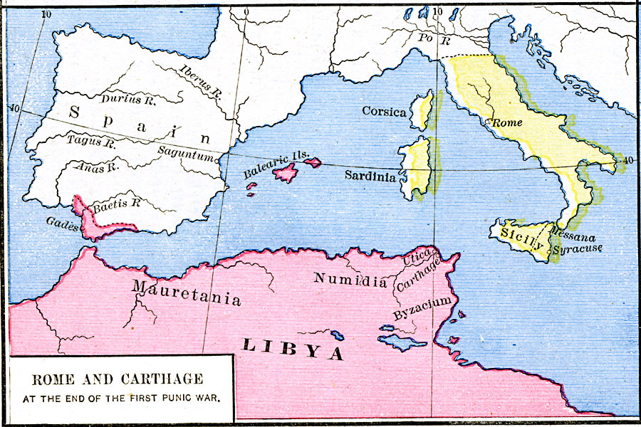
Description: A map of Rome and Carthage at the end of the First Punic War (264–241 BC). This map is color–coded to show the extent of the Roman Empire in yellow and the Carthaginian territory in pink. By the end of the First Punic War, the Roman Empire had expanded to the northern Italian Peninsula, and included the islands of Corsica, Sardinia, and Sicily. The Carthaginian territories included the northern African territories of Mauretania, Numidia, Byzacium, and Libya, the Balearic Islands, and the southern coastal area of Iberia near Gades (Cadiz) and Gibraltar. This map shows important cities and rivers of the time.
Place Names: Italy, Carthage, �Corsica, �Italy, �Libya, �Rome, �Sardinia, �Sicily,
ISO Topic Categories: oceans,
location,
inlandWaters
Keywords: Rome and Carthage at the end of the first Punic War, borders, �historical, kRomanEmpire, other military, oceans,
location,
inlandWaters, Unknown, 241 BC
Source: Robert H. Labberton, New Historical Atlas and General History (New York, NY: Townsend MacCoun, 1886) Plate XV
Map Credit: Courtesy the private collection of Roy Winkelman |
|