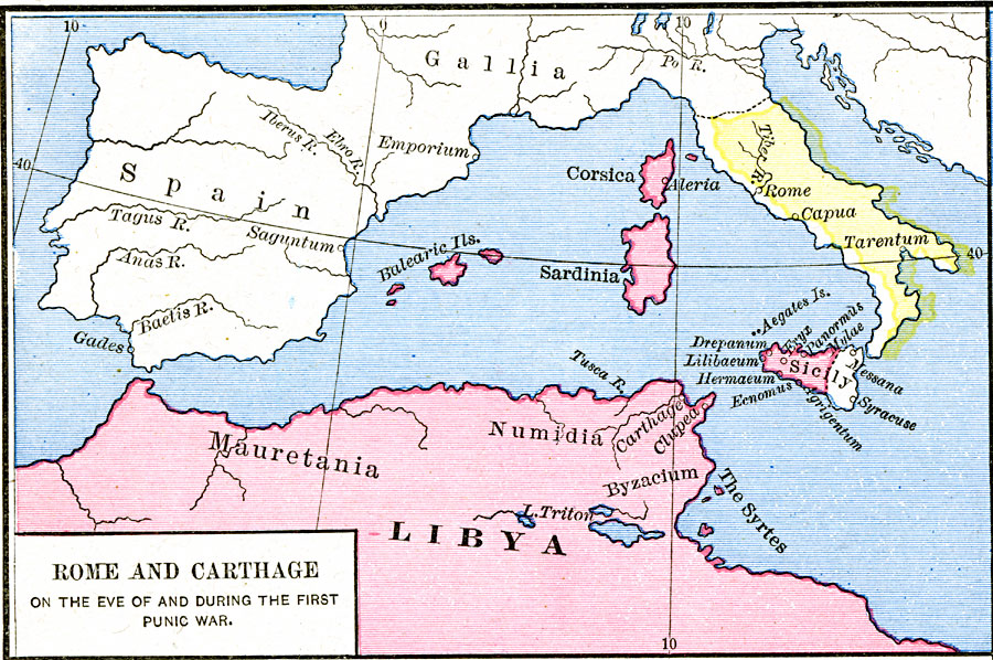
Description: A map of Rome and Carthage during the First Punic War (264–241 BC). This map is color–coded to show the extent of the Roman Empire in yellow and the Carthaginian territory in pink. At the beginning of the war, the Roman Empire covered the Italian Peninsula south of the River Tiber, while the Carthaginians controlled the northern African territories of Mauretania, Numidia, Byzacium, and Libya, the Balearic Islands, Corsica, Sardinia, and the western two–thirds of Sicily (Greek Syracuse controlled the eastern portion). This map shows important cities and rivers of the time.
Place Names: Italy, Carthage, �Corsica, �Italy, �Libya, �Rome, �Sardinia, �Sicily,
ISO Topic Categories: oceans,
location,
inlandWaters
Keywords: Rome and Carthage on the eve of and during the first Punic War, borders, �historical, kRomanEmpire, other military, oceans,
location,
inlandWaters, Unknown, 264–241 BC
Source: Robert H. Labberton, New Historical Atlas and General History (New York, NY: Townsend MacCoun, 1886) Plate XV
Map Credit: Courtesy the private collection of Roy Winkelman |
|