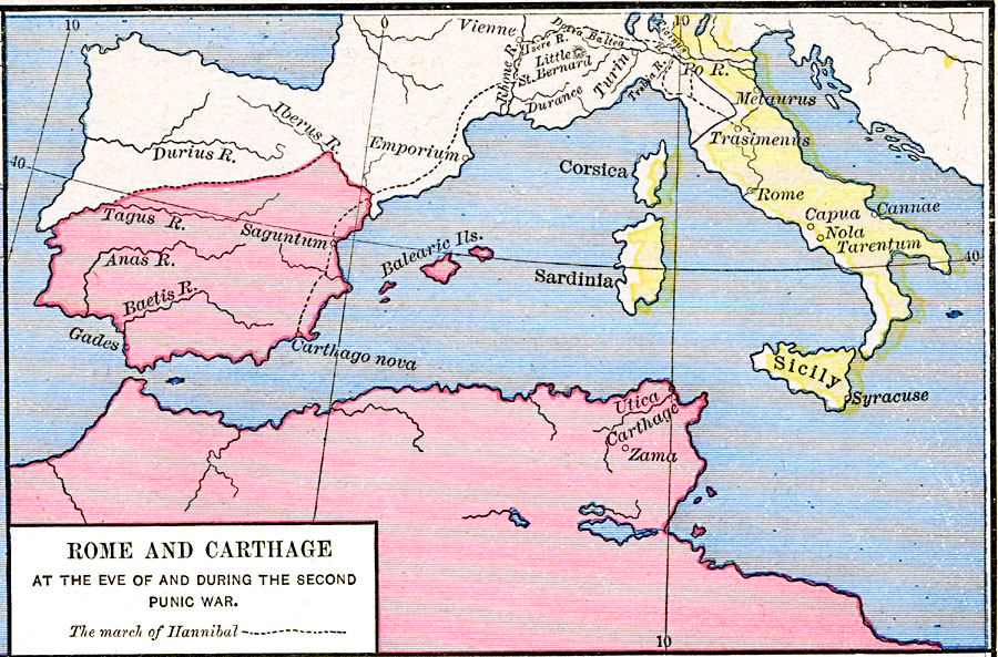
Description: A map of Rome and Carthage during the Second Punic War (218–201 BC). This map is color–coded to show the extent of the Roman Empire in yellow and the Carthaginian territory in pink. At this time, the Roman Empire was primarily restricted to the central and southern Italian Peninsula, and the islands of Corsica, Sardinia, and Sicily. The Carthaginian territories covered much of North Africa, the Iberian Peninsula south from the Tagus River to the Iberus River, and the Balearic Islands. This map shows the route of Hannibal from Carthago Nova in Spain to Trasimenus, Italy.
Place Names: Italy, Carthage, �Corsica, �Italy, �Libya, �Rome, �Sardinia, �Sicily,
ISO Topic Categories: oceans,
location,
inlandWaters
Keywords: Rome and Carthage at the end of the second Punic War, borders, �historical, kRomanEmpire, other military, oceans,
location,
inlandWaters, Unknown, 218–201 BC
Source: Robert H. Labberton, New Historical Atlas and General History (New York, NY: Townsend MacCoun, 1886) Plate XV
Map Credit: Courtesy the private collection of Roy Winkelman |
|