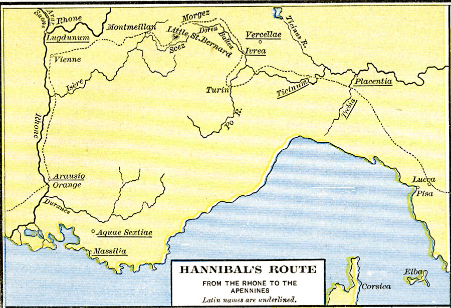
Description: A map of Hannibal's Route from the Rhone to the Apennines during the Second Punic War against the Romans. This map shows the Little St. Bernard pass through the Alps, the river crossings of the Rhone, Isère, Dorea Baltea, Po, and Trebia, and several important cities along his route, including Arausio (Orange), Vienne, Montmeillan, Ivrea, Turin, Ticinum, and Lucca. Other important cities shown are Lugdunum, Aquae Sextiae, Massilia, Vercellae, Placentia, and Pisa.
Place Names: Western and Central Europe, Arausio, �Corsica, �Lugdunum, �Vienn
ISO Topic Categories: oceans,
location,
inlandWaters
Keywords: Hannibal's Route from the Rhone to the Apennines, borders, �historical, kHannibal, historical event, oceans,
location,
inlandWaters, Unknown, 218–217 BC
Source: Robert H. Labberton, New Historical Atlas and General History (New York, NY: Townsend MacCoun, 1886) Plate XVI
Map Credit: Courtesy the private collection of Roy Winkelman |
|