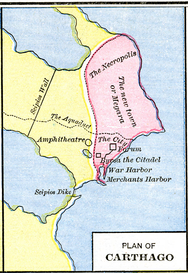
Description: A plan of the Punic city of Carthago (Carthage) in on the northern African coast of today's Tunisia at the end of the Third Punic War, around 146 BC. This map shows the large necropolis to the north of the city, the Amphitheatre, Forum and Byrsa the Citadel, the War and Merchant's harbors, and the new town or Megara (after Megara Greece). Also shown is the city aqueduct, Scipios Wall and Scipios Dike, referring to the Roman commander Scipio.
Place Names: Tunisia, Amphitheatre, �Carthage, �Megara, �Necropoli
ISO Topic Categories: oceans,
location,
inlandWaters
Keywords: Plan of Carthago, borders, �historical, historical event, oceans,
location,
inlandWaters, Unknown, 146 B.C.
Source: Robert H. Labberton, New Historical Atlas and General History (New York, NY: Townsend MacCoun, 1886) Plate XVI
Map Credit: Courtesy the private collection of Roy Winkelman |
|