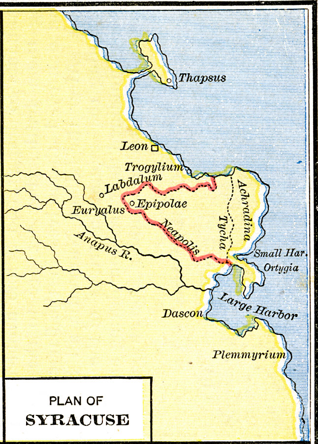
Description: A plan of the Greek colony of Syrakousa (Syracuse) on the eastern coast of the island of Sikelia (Sicily) in what was a portion of the Magna Graecia region in circa 200 to 50 BC. The map shows the sites of Epipolae within the Neapolis boundary, the coastal section of Achradina, and the inland section of Tycha. The map shows the natural harbors and peninsula of Ortygia, the river Anapus, and neighboring areas of Trogylium, Euryalus, Dascon, and Plemmyrium.
Place Names: Italy, Achradina, �Epipolae, �Labdalum, �Neapolis, �Tych
ISO Topic Categories: oceans,
location,
inlandWaters
Keywords: Plan of Syracuse, borders, �historical, kAncientGreece, historical event, oceans,
location,
inlandWaters, Unknown, 200–50 B.C.
Source: Robert H. Labberton, New Historical Atlas and General History (New York, NY: Townsend MacCoun, 1886) Plate XVI
Map Credit: Courtesy the private collection of Roy Winkelman |
|