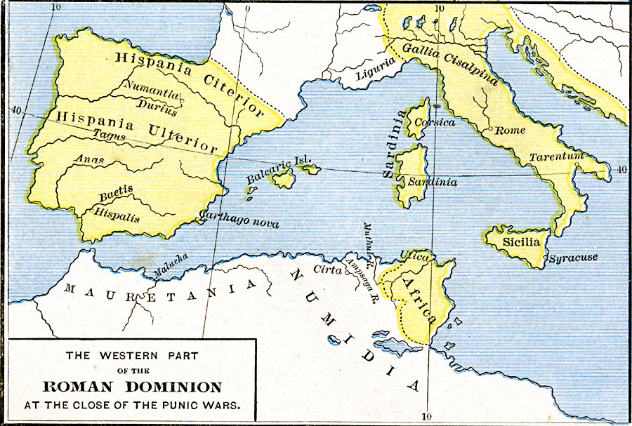
Description: A map of the western portion of the Roman Empire at the close of the Punic Wars in 146 BC, showing the extent of the Empire in Hispania and Gallia Cisalpina, its borders with unconquered Gallia, and its extent in northern Africa restricted to the territories of Utica and Carthage.
Place Names: Mediterranean Europe, Africa, �Italy, �Sardinia, �Sicily, �Spain,
ISO Topic Categories: oceans,
location,
inlandWaters
Keywords: The Western Part of the Roman Dominion at the Close of the Punic Wars, borders, �historical, kRomanEmpire, historical event, oceans,
location,
inlandWaters, Unknown, 146 BC
Source: Robert H. Labberton, New Historical Atlas and General History (New York, NY: Townsend MacCoun, 1886) Plate XVI
Map Credit: Courtesy the private collection of Roy Winkelman |
|