mapsMaps ETC Site map
 Maps ETC > Europe > Mediterranean Europe > The Western Part of the Roman Dominion One Century after the Close of the Punic Wars, 46 B.C.
Site Map 

The Western Part of the Roman Dominion One Century after the Close of the Punic Wars, 46 B.C.

The Western Part of the Roman Dominion One Century after the Close of the Punic Wars


Title: The Western Part of the Roman Dominion One Century after the Close of the Punic Wars
Projection: Unknown,
Source Bounding Coordinates:
W: -10 E: 20 N: 44 S: 30

Main Map Page
Zoomify Version
B/W PDF Version
Color PDF Version
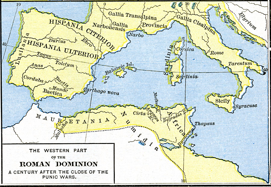
Description: A map of the western portion of the Roman Empire in 46 BC, a century after the close of the Punic Wars, showing the extent of the Empire across modern France and in north Africa.
Place Names: Mediterranean Europe, Africa, Italy, Mauretania, Numidia, Sardinia, Sicily, Spain,
ISO Topic Categories: oceans, location, inlandWaters
Keywords: The Western Part of the Roman Dominion One Century after the Close of the Punic Wars, borders, historical, kRomanEmpire, historical event, oceans, location, inlandWaters, Unknown, 46 B.C.
Source: Robert H. Labberton, New Historical Atlas and General History (New York, NY: Townsend MacCoun, 1886) Plate XVI
Map Credit: Courtesy the private collection of Roy Winkelman
SearchLicensePDF HelpGIS Help Google Earth Help Zoomify Help

 Maps ETC > Europe > Mediterranean Europe > The Western Part of the Roman Dominion One Century after the Close of the Punic Wars, 46 B.C.
Site Map