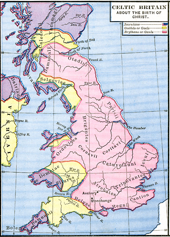
Description: Map of Celtic Britain about the birth of Christ. This map is color–coded to differentiate between the Ivernians, Goidels or Gaels, and Brythans or Gauls. The names of Celtic tribes are shown, as well as rivers, coastal features, and the locations of Avebury and Stonhenge.
Place Names: United Kingdom, Britain, �Ivernia, �Ireland, �United Kingdom
ISO Topic Categories: oceans,
location,
inlandWaters
Keywords: Celtic Britain about the Birth of Christ, borders, oceans,
location,
inlandWaters, Unknown, about A.D. 1
Source: Robert H. Labberton, New Historical Atlas and General History (New York, NY: Townsend MacCoun, 1886) Plate XVIII
Map Credit: Courtesy the private collection of Roy Winkelman |
|