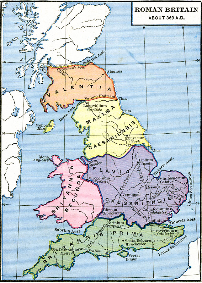
Description: Map of Roman Britain about AD 369 showing the provinces of Britannia Prima, Flavia Caesariensis, Britannia Secunda, Maxima Caesarensis, and Valentia. The map shows important cities of the time with Latin names and modern names italicized, including Londinium (London), Isca Damnoniorum (Exeter), Dubris (Dover), Lindum (Lincoln), Eburacum (York), and Luguvallium (Carlisle). The map shows the northern fortifications against the Picts at Vallum Hadriani (Hadrian's Wall) and Vallum Antonini (Antonine or Severan Wall), Roman roads, including the Fosse Way, Watling Street, Icknield Street, and Hermin Street. Coastal features and islands with Latin names are shown.
Place Names: United Kingdom, Britannia Prima, Flavia Caesariensis, Britannia Secunda, Maxima Caesarensis, Valentia, Londinium, London, Isca Damnoniorum, Exeter, Dubris, Dover, Lindum, Lincoln, Eburacum, York, Luguvallium, Carlisle
ISO Topic Categories: oceans,
location,
inlandWaters
Keywords: Roman Britain, borders, kRomanEmpire, oceans,
location,
inlandWaters, Unknown, A.D 369
Source: Robert H. Labberton, New Historical Atlas and General History (New York, NY: Townsend MacCoun, 1886) Plate XVIII
Map Credit: Courtesy the private collection of Roy Winkelman |
|