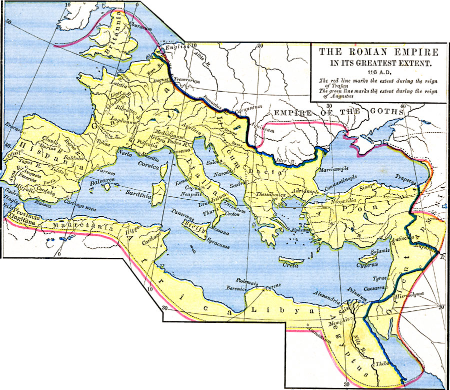
Description: A map of Europe and the Mediterranean in AD 116, showing the provinces of the Roman Empire in its greatest extent. This map shows the Roman territories in color, with the extent of the empire under Trajan (AD 53–117) bordered in red, and the extent under Augustus (63 BC – AD 19) bordered in green. The map shows the divisions of the Empire, major rivers, important cities of the period, and the territories of the Empire of the Goths.
Place Names: Regional Mediterranean, Africa, �Asia, �Armenia, �Egypt, �France, �Greece, �Italy, �Spain, �Syri
ISO Topic Categories: borders, kRomanEmpire, kWorldMedSea, kWorldAfroAsia, kWorldEurasia, kWorldEuroAfrica
Keywords: The Roman Empire in its Greatest Extent, borders, kRomanEmpire, borders, kRomanEmpire, kWorldMedSea, kWorldAfroAsia, kWorldEurasia, kWorldEuroAfrica, Unknown, AD 116
Source: Robert H. Labberton, New Historical Atlas and General History (New York, NY: Townsend MacCoun, 1886) Plate XIX
Map Credit: Courtesy the private collection of Roy Winkelman |
|