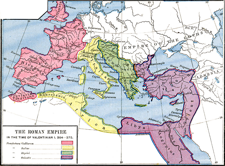
Description: A map of the Roman Empire in the Time of Valentinian I, "the last great western emperor," AD 364–375. The map is color–coded to show the Praefectura Galliorum (Gallia, Britannia, Hispania, and Provincia Tingitana), Praefectura Italiae (Italia, Sicily, Corsica, Sardinia, Mauretania–Africa), Praefectura Illyrici (Illyricum, Dacia, Macedonia, and western Moesia), and Praefectura Orientis (eastern Moesia, Thracia, Pontus, Asia Orient, Aegyptus, and Libya). Major rivers with their Latin names and important cities of the time are shown.
Place Names: Regional Mediterranean, Africa, �Asia, �Armenia, �Egypt, �France, �Greece, �Italy, �Libya, �Spain, �Syri
ISO Topic Categories: borders, kRomanEmpire, kWorldMedSea, kWorldAfroAsia, kWorldEurasia, kWorldEuroAfrica
Keywords: The Roman Empire in the Time of Valentinian I, borders, kRomanEmpire, borders, kRomanEmpire, kWorldMedSea, kWorldAfroAsia, kWorldEurasia, kWorldEuroAfrica, Unknown, A.D. 364–375
Source: Robert H. Labberton, New Historical Atlas and General History (New York, NY: Townsend MacCoun, 1886) Plate XX
Map Credit: Courtesy the private collection of Roy Winkelman |
|