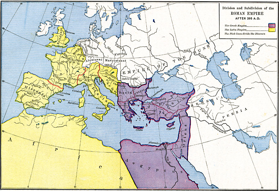
Description: A map showing the division and subdivision of the Roman Empire after A.D. 395, indicating the Greek or Byzantine Empire in the east and the Latin Empire in the west. The empires are further broken into Dioceses, including Dacia, Thracia, Macedonia, Creta, Pontus, Asia, Cyprus, Oriens, and Aegyptus in the Byzantine Empire, and Illyricum, Italia, Gallia, Britannia, Hispania, and northern Africa in the Latin Empire. Non–Roman areas and peoples are also shown, including the Empire of the Huns, Armenia, Persia, Alemanni with the Saxons, English, Franks, and Burgundians, and Marcomanni with the Vandals. Important cities of the time are also shown, including the capital cities of Rome and Constantinople, and Consentia, Carthage, Hippo, Carthago nova, Pollentia, Chalons, Augusta Treverorum, Eburacum, Marianople, Thessulonica, Antioch, and Alexandria.
Place Names: Regional Mediterranean, Africa, �Asia, �Armenia, �Egypt, �France, �Greece, �Italy, �Libya, �Spain, �Syri
ISO Topic Categories: borders, kRomanEmpire, kWorldMedSea, kWorldAfroAsia, kWorldEurasia, kWorldEuroAfrica
Keywords: Division and Subdivision of the Roman Empire, borders, kRomanEmpire, borders, kRomanEmpire, kWorldMedSea, kWorldAfroAsia, kWorldEurasia, kWorldEuroAfrica, Unknown, A.D. 395
Source: Robert H. Labberton, New Historical Atlas and General History (New York, NY: Townsend MacCoun, 1886) Plate XXI
Map Credit: Courtesy the private collection of Roy Winkelman |
|
