mapsMaps ETC Site map
 Maps ETC > Globes and Multi-continent > Regional Mediterranean > Europe and Western Asia at the beginning of the Reign of Theodoric the Ostro-goth, A.D. 494
Site Map 

Europe and Western Asia at the beginning of the Reign of Theodoric the Ostro-goth, A.D. 494

Europe and Western Asia at the beginning of the Reign of Theodoric the Ostro-goth


Title: Europe and Western Asia at the beginning of the Reign of Theodoric the Ostro-goth
Projection: Unknown,
Source Bounding Coordinates:
W: -20 E: 60 N: 55 S: 25

Main Map Page
Zoomify Version
B/W PDF Version
Color PDF Version
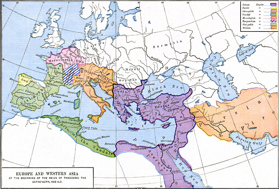
Description: Map showing the Division and Subdivision of the Roman Empire after 395 A. D. Map is color–coded to differentiate between the various groups inhabiting the area.
Place Names: Regional Mediterranean, Asia, Egypt, Europe, Greece, Italy, Persia, Spai
ISO Topic Categories: borders, kWorldMedSea, kWorldAfroAsia, kWorldEurasia, kWorldEuroAfrica
Keywords: Europe and Western Asia at the beginning of the Reign of Theodoric the Ostro-goth, borders, borders, kWorldMedSea, kWorldAfroAsia, kWorldEurasia, kWorldEuroAfrica, Unknown, A.D. 494
Source: Robert H. Labberton, New Historical Atlas and General History (New York, NY: Townsend MacCoun, 1886) Plate XXII
Map Credit: Courtesy the private collection of Roy Winkelman
SearchLicensePDF HelpGIS Help Google Earth Help Zoomify Help

 Maps ETC > Globes and Multi-continent > Regional Mediterranean > Europe and Western Asia at the beginning of the Reign of Theodoric the Ostro-goth, A.D. 494
Site Map