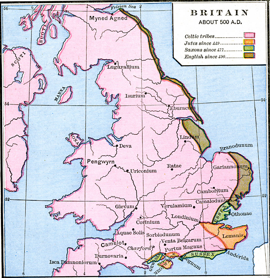
Description: A map of Britain about AD 500. This map is color–coded to show the territories of the Celtic tribes, the Jutes since 449, the Saxons since 477, and the English since 490. The map shows important cities and ports of the time, labeled with their Roman names (Londinium, Ratae, Branodunum) and Celtic names (Pengwyrn, Myned Agned, Camelot).
Place Names: United Kingdom, Camelot, �Essex, �Myned Agned, �Pengwyrn, �Scoti, �Susse
ISO Topic Categories: oceans,
location,
inlandWaters,
boundaries
Keywords: Britain, borders, oceans,
location,
inlandWaters,
boundaries, Unknown, AD 500
Source: Robert H. Labberton, New Historical Atlas and General History (New York, NY: Townsend MacCoun, 1886) Plate XXIV
Map Credit: Courtesy the private collection of Roy Winkelman |
|