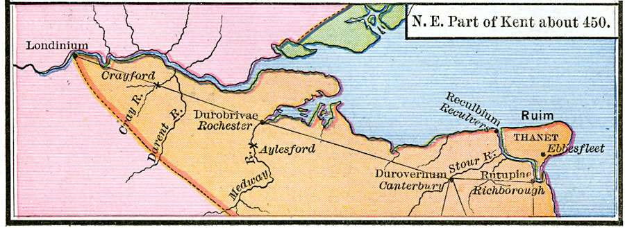
Description: A map of northeast Kent and the Thames Estuary at the time of the Saxon invasions, around AD 450. The map is color–coded to show the territories of the Britons in pink, the Saxons in orange, and the Angles in green. Although the Romans departed the area in AD 410, this map shows the Roman settlements and road between Londinium (London), Durobrivae (Rochester), Durovernum (Canterbury), Rutupiae (Richborough). The map shows Ruim (Thanet) as an island, separated by the river at Reculbium (Reculvers). This map shows the battle sites of Aylesford (AD 455) and Crayford (AD 457), and the landing site of St. Augustine (AD 597) at Ebbsfleet.
Place Names: United Kingdom, Kent,
ISO Topic Categories: oceans,
location,
inlandWaters,
boundaries
Keywords: The Saxon Invasion of Kent, borders, oceans,
location,
inlandWaters,
boundaries, Unknown, AD 450
Source: Robert H. Labberton, New Historical Atlas and General History (New York, NY: Townsend MacCoun, 1886) Plate XXIV
Map Credit: Courtesy the private collection of Roy Winkelman |
|