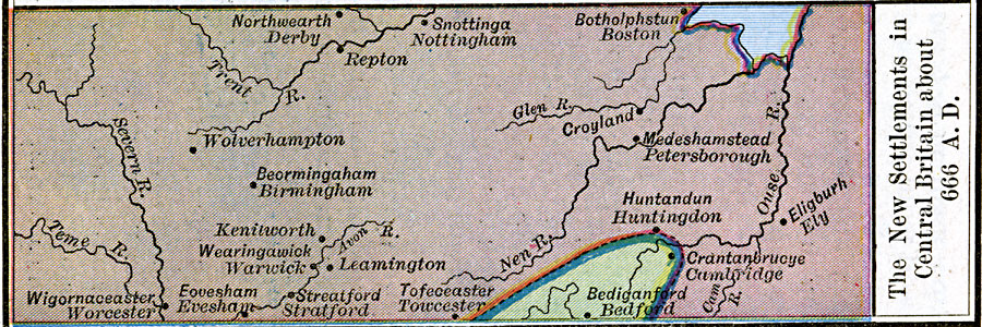
Description: A map of central England showing the "new" settlements of the Anglo–Saxons in the area around AD 666. This map shows the settlements with their Saxon names and modern names, including Northwearth (Derby), Snottinga (Nottingham), Botholphstun (Boston), Repton, Croyland, Wolverhampton, Beormingaham (Birmingham), Medeshamstead (Petersborough), Eligburh (Ely), Huntandun (Huntingdon), Crantanbrueye (Cambridge), Bediganford (Bedford), Tofeceaster (Towcester), Leamington, Keniworth, Wearingawick (Warwick), Streatford (Stratford), Eovesham (Evesham), and Wigornaceaster (Worcester).
Place Names: United Kingdom, Bedford, �Birmingham, �Cambridge, �Derby, �Evesham, �Huntingdon, �Nottingham, �Stratford, �Worceste
ISO Topic Categories: oceans,
location,
inlandWaters
Keywords: The New Settlements in Central Britain, borders, �historical, other military, oceans,
location,
inlandWaters, Unknown, AD 666
Source: Robert H. Labberton, New Historical Atlas and General History (New York, NY: Townsend MacCoun, 1886) Plate XXV
Map Credit: Courtesy the private collection of Roy Winkelman |
|