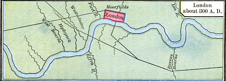
Description: A map of the area around London circa AD 800 when it was in Saxon territory, after the abandonment by the Romans (AD 410) and before the Viking invasions (AD 842). This map shows the site of London on the River Thames, the Roman roads in the vicinity, the areas of Hydepark, Westminster, and Moorfields outside the city, and the rivers West Bourne, Fleet, Effra, Lea, and Ravens Bourne.
Place Names: United Kingdom, Londo
ISO Topic Categories: oceans,
location,
inlandWaters
Keywords: Saxon London, borders, oceans,
location,
inlandWaters, Unknown, AD 800
Source: Robert H. Labberton, New Historical Atlas and General History (New York, NY: Townsend MacCoun, 1886) Plate XXVI
Map Credit: Courtesy the private collection of Roy Winkelman |
|