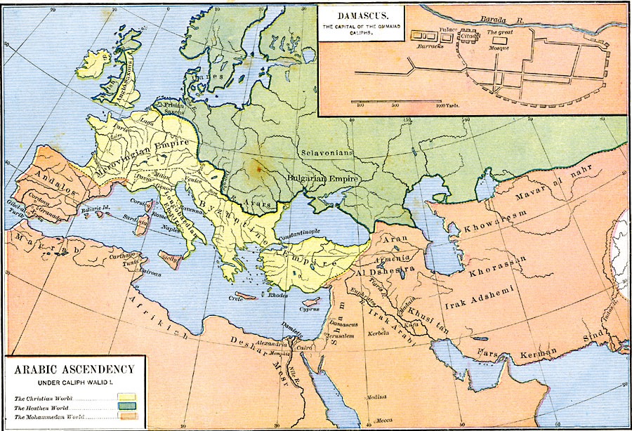
Description: A map showing the Arabic Ascendancy under Caliph Walid I at the time of his death in 715. The map is color–coded to indicate the Christian World, Heathen World, and Mohammedan World, and shows the Andalos in Spain and Portugal, with proximity to the Merovingian Empire, Longobardian Empire, Byzantine Empire, and the Bulgarian Empire. The inset map shows Damascus, the capital of the Ommaiad Caliphs along the Barada River.
Place Names: Regional Miscellaneous, Africa, �Andalos, �Bulgarian Empire, �Byzantine Empire, �Crete, �Cyprus, �Merovingian Empire, �Iran, �Magrab, �Sicil
ISO Topic Categories: borders, kWorldMedSea, kWorldAfroAsia, kWorldEurasia, kWorldEuroAfrica
Keywords: Arabic Ascendancy under Caliph Walid I, borders, borders, kWorldMedSea, kWorldAfroAsia, kWorldEurasia, kWorldEuroAfrica, Unknown, AD 715
Source: Robert H. Labberton, New Historical Atlas and General History (New York, NY: Townsend MacCoun, 1886) Plate XXVII
Map Credit: Courtesy the private collection of Roy Winkelman |
|