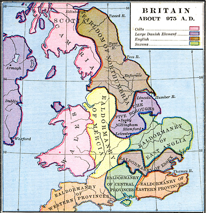
Description: A map of Britain in AD 975 at the beginning of the Viking (Dane) invasions. The map is color–coded to show the territories of the Celts (Scotia, Cambria, and Wales), the areas having a large Danish element (Ireland and the Five Boroughs), the English Earldom, and ealdormanries of the south.
Place Names: United Kingdom, Anglia, �Cambria, �Ealdormanry, �Essex, �Mercia, �Northumbria, �Scotia, �Wales,
ISO Topic Categories: oceans,
location,
inlandWaters,
boundaries
Keywords: Britain, borders, oceans,
location,
inlandWaters,
boundaries, Unknown, AD 975
Source: Robert H. Labberton, New Historical Atlas and General History (New York, NY: Townsend MacCoun, 1886) Plate XXIX
Map Credit: Courtesy the private collection of Roy Winkelman |
|