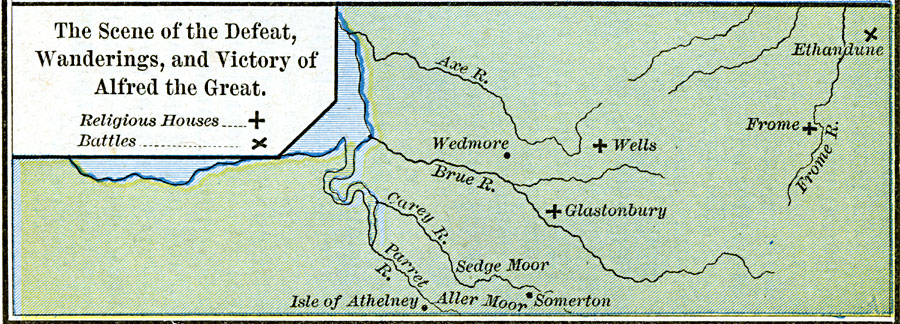
Description: A map of the area in Somerset and Wiltshire, England, at the time of Alfred the Great (AD 847–899), showing the place of his retreat from the Danes (Isle of Atheleny), the battlefield where he defeated the Vikings under Guthrum in AD 878 (Ethandune, or Edington), and Wedmore, where Guthrum was baptized and accepted Alfred's treaty ending the conflict and sending the Vikings back to East Anglia. This map also shows the religious houses Glastonbury, Wells, and Frome.
Place Names: United Kingdom, Glastonbury, �Somerton, �Wedmore, �Well
ISO Topic Categories: oceans,
location,
inlandWaters
Keywords: The Scene of the Defeat, Wanderings, and Victory of Alfred the Great, borders, �historical, other military, oceans,
location,
inlandWaters, Unknown, AD 871–899
Source: Robert H. Labberton, New Historical Atlas and General History (New York, NY: Townsend MacCoun, 1886) Plate XXIX
Map Credit: Courtesy the private collection of Roy Winkelman |
|