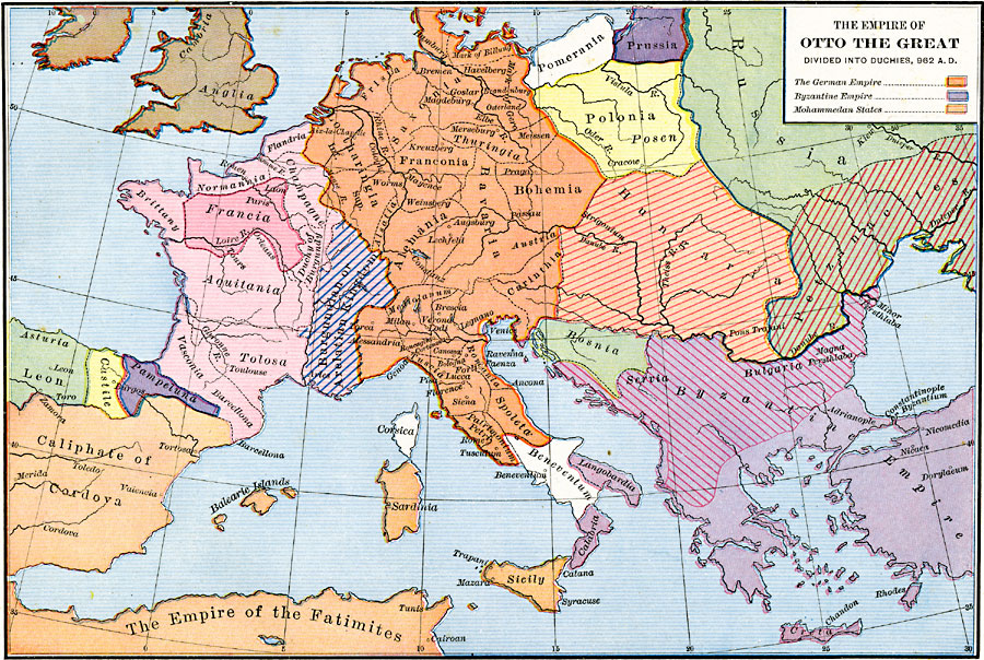
Description: A map of Europe after the Empire of Otto the Great was divided into Duchies in AD 962. This map is color–coded to show the territories of the German Empire, which included Frisia, Lotharingia, Saxonia, Thuringia, Franconia, Bohemia, Bavaria, Alemania, Carinthia, Mediolanum, Alessandria, Tuscia, Romania, Spoleta, and Patrimonium Petri, the Byzantine Empire, which included Servia, Bulgaria, Langobardia, and Calabria, the territories of Pomerania, Prussia, Polonia, Bosnia, Beneventum, Corsica, Leon, Castile, Pampeluna, Vasconia, Barcellona, Tolusa, Aquitania, Burgundian or Arelatian Kingdom, Duchy of Burgundy, Brittany, Francia, Normannia, Champagne, Flandria, and Anglia in the British Isles. The map also shows the Mohammedan states of the Caliphate of Cordova in Spain, the Balearic Islands, Sardinia, Sicily, and the Empire of the Fatimites in North Africa.
Place Names: Western and Central Europe, Bavaria, �Bosnia, �France, �Greece, �Hungary, �Italy, �Poland, �Prussia, �Russia, �Serbia, �Sicil
ISO Topic Categories: oceans,
location,
inlandWaters
Keywords: The Empire of Otto the Great divided into Duchies, borders, �historical, other military, oceans,
location,
inlandWaters, Unknown, A.D. 962
Source: Robert H. Labberton, New Historical Atlas and General History (New York, NY: Townsend MacCoun, 1886) Plate XXX
Map Credit: Courtesy the private collection of Roy Winkelman |
|