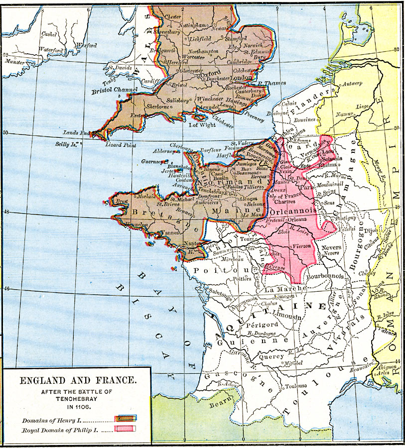
Description: A map of southern England and western France after the Battle of Tenchebray between Henry I of England and the Duke of Normandy in 1106. The map is color–coded to show the domains of Henry I, including Normandy Maine and Bretagne in France, and the royal domains Philip I, Orleannois. The map shows major cities at the time, rivers, and the western extent of the Roman Empire.
Place Names: Western Europe, Aquitane, �Bretagne, �Flanders, �Maine, �Normandy, �Orleannois, �Oxford, �Wales,
ISO Topic Categories: oceans,
location,
inlandWaters,
boundaries
Keywords: England and France after the Battle of Tenchebray, borders, �historical, other military, oceans,
location,
inlandWaters,
boundaries, Unknown, A.D. 1106
Source: Robert H. Labberton, New Historical Atlas and General History (New York, NY: Townsend MacCoun, 1886) Plate XXXII
Map Credit: Courtesy the private collection of Roy Winkelman |
|