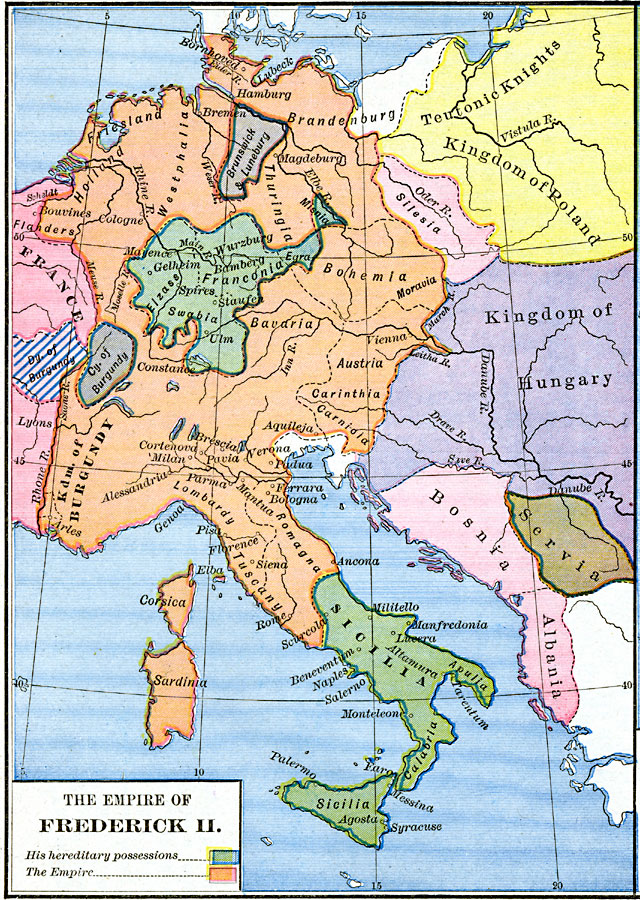
Description: A map of the Empire of Frederick II, Holy Roman Emperor, 1215–1250, showing his hereditary possessions in Franconia and Swabia (Germany) and Sicily (including the southern portion of the Italian Peninsula), and the extent of his empire in central Europe, which included Friesland, Holland, Westphalia, Thuringia, the western portion of Brandenburg, Bohemia, Bavaria, Austria, the Kingdom of Burgundy, Romagna, Lombardy, Tuscany, Corsica, and Sardinia. The map is color–coded to show the other territories of the time, including the eastern portion of France, the Duchy of Burgundy, Brunswick–Luneburg, City of Burgundy, the territory of the Teutonic Knights, Kingdom of Poland, Silesia, Kingdom of Hungary, Servia, Bosnia, and Albania.
Place Names: Western and Central Europe, Albania, �Bosnia, �Burgundy, �France, �Germany, �Greece, �Holland, �Hungary, �Poland, �Serbia, �Sicil
ISO Topic Categories: oceans,
location,
inlandWaters,
boundaries
Keywords: The Empire of Frederick II, borders, �historical, historical event, oceans,
location,
inlandWaters,
boundaries, Unknown, AD 1215–1360
Source: Robert H. Labberton, New Historical Atlas and General History (New York, NY: Townsend MacCoun, 1886) Plate XXXV
Map Credit: Courtesy the private collection of Roy Winkelman |
|