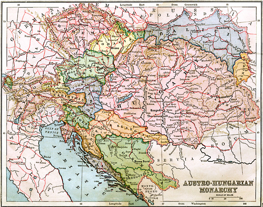
Description: A map showing the territories of the Austro–Hungarian Monarchy in 1883, including major cities and towns, railroads, and rivers. The map is color–coded to show the territories of Bohemia, Moravia, Silesia, Galicia, Austria, Hungary (including Transylvania), Bukowinia, Tyrol, Styria, Carinthia, Carniola, Croatia and Slovenia, Isthia, Bosnia–Herzegovina, and Dalmatia.
Place Names: Austria-Hungary, Vienna, �Lemburg, �Prague, �Salzburg, �Budapes
ISO Topic Categories: boundaries,
inlandWaters,
location
Keywords: Austro-Hungarian Monarchy, physical, �political, physical features, country borders, boundaries,
inlandWaters,
location, Unknown, 1883
Source: , Handy Atlas of the World (New York, New York: Ivison, Blakeman, Taylor and Co., 1883) 25
Map Credit: Courtesy the private collection of Roy Winkelman |
|