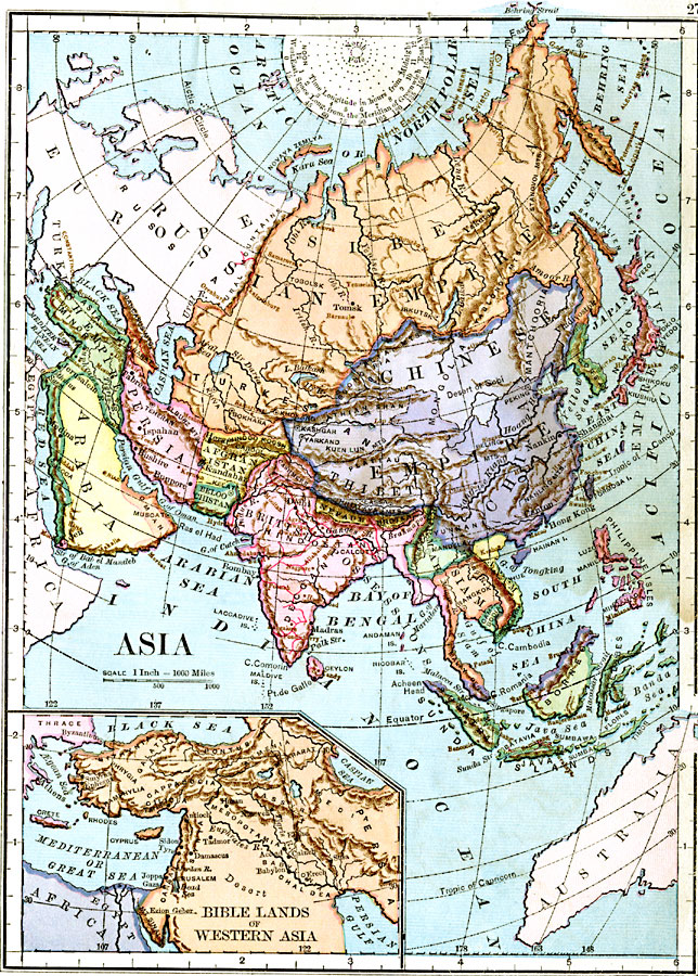
Description: A map of Asia from 1883 showing country boundaries at the time, major cities, railroads, rivers, lakes, terrain, and coastal features. An inset map details the Biblical lands in western Asia.
Place Names: A Complete Map of Asia, Russian Empire, �Siberia, �Empire of Japan, �Chinese Empire, �Thibet, �China, �Arabia, �Turkish Empire, �Persia, �Afghanistan, �Turkestan, �Nepaul, �Hindostan, �Burmah, �Siam, �Corea, �Cambodia, �Sumatra, �Anam, �Borneo, �Philippine Isles,
ISO Topic Categories: boundaries,
inlandWaters,
location,
oceans
Keywords: Asia and Biblical Lands, physical, �political, physical features, country borders, boundaries,
inlandWaters,
location,
oceans, Unknown, 1883
Source: , Handy Atlas of the World (New York, NY: Ivison, Blakeman, Taylor and Co., 1883) 27
Map Credit: Courtesy the private collection of Roy Winkelman |
|